
These links are a broad survery of sites arranged by topic. If you have any suggestions of relevant sites we should add, please refer to our Contact Us page to submit a suggestion.
General Leadville Information
Leadville Museums and Historical Buildings Sites
- Museum list: by Colorado Info
- Temple Israel
- Healy House Museum and Dexter Cabin
- National Mining Hall of Fame and Museum
- The Matchless Mine
- Tabor Opera House
- Tabor Home
- House with the Eye Museum
- Hopemore Mine
- The Heritage Museum
- Leadville Colorado and Southern Railroad
- Climax Molybdenum Mine
(There is an outdoor exhibit across from the mine entrance.)
Facts of 21st Century Leadville
Here are some basic facts about Leadville in the 21st Century.
- Named as "Leadville" in 1877
- Incorporated on February 18, 1878
- Leadville is in Lake County and is the main city in the county
- Official elevation of 10,152
- Known as the Two Mile High City, Cloud City, Pb, and xxxxxx
- Area of town: 1.1 sq mi (2.86 km²)
- Population: 2,602 (2010 census)
- Is in the Mountain Time Zone
- Is just east of the Continental Divide
- Is just east of the Arkansas River
- In the 1800s, Leadville was the second most populous town in Colorado. Denver was the most populous.
- Leadville was once in the running to be the state capitol of Colorado
- Coordinates: 39°15'00"N 106°17'30"W
- Area code: 719
- Zipcode: 80461
- Summer temperatures will rarely be above 80°F, and is usually in the 70s or 60s.
- Average annual snowfall is over 200".
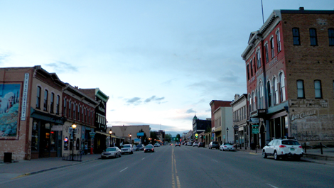
View looking North from the South end of Harrison Avenue
(at 3rd Street) in Leadville, 2014.
Photograph by RG de Stolfe.